Log in
All resources
Create a design
183,459 Free Images of Maps With Figures
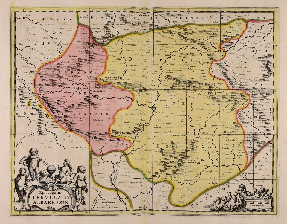
maps made in the 17th century
geographical illustrations by coronelli
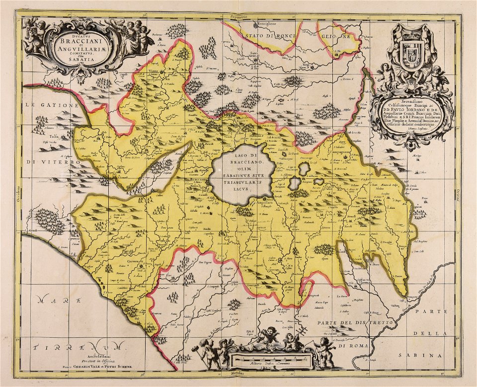
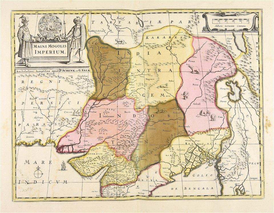
gerard valck
maps by pieter schenk (i)
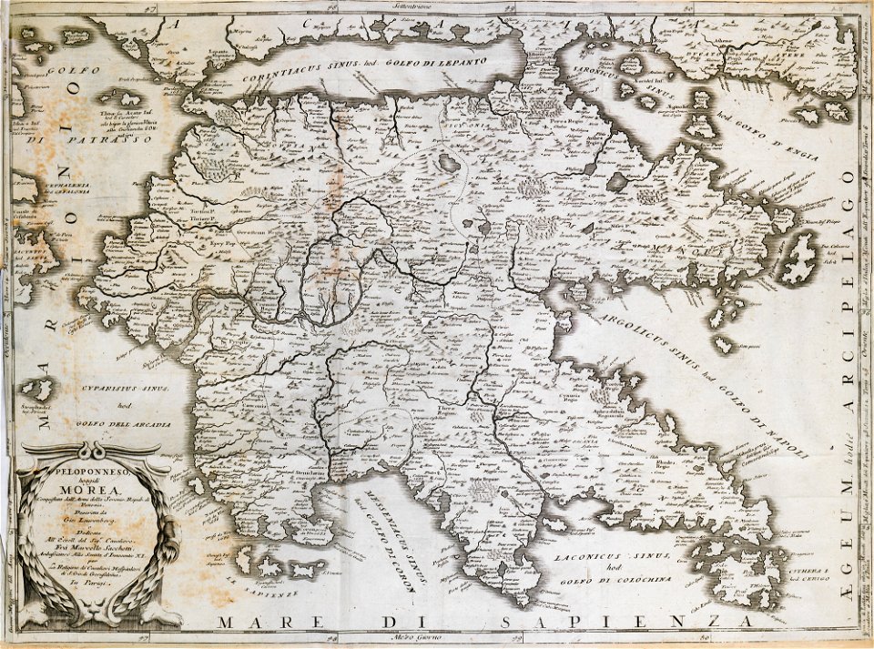
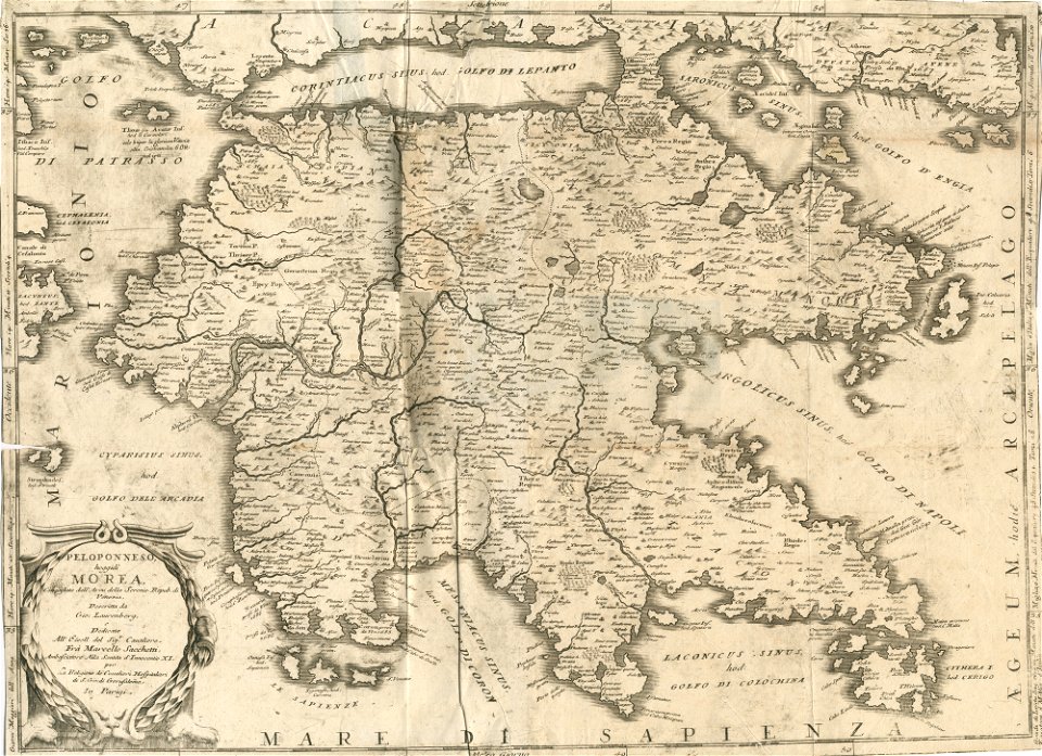
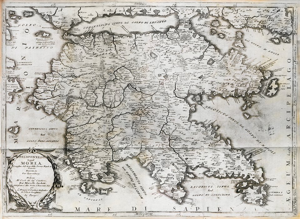
old maps of the peloponnese
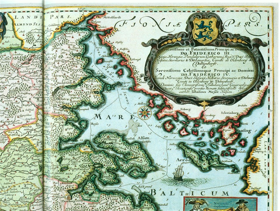
maps by johannes mejer
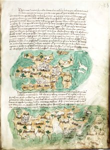
atlantis magni tomus quartus (biblioteca comunale di trento)
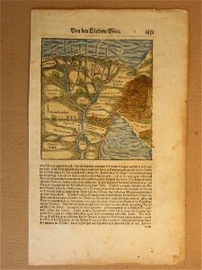
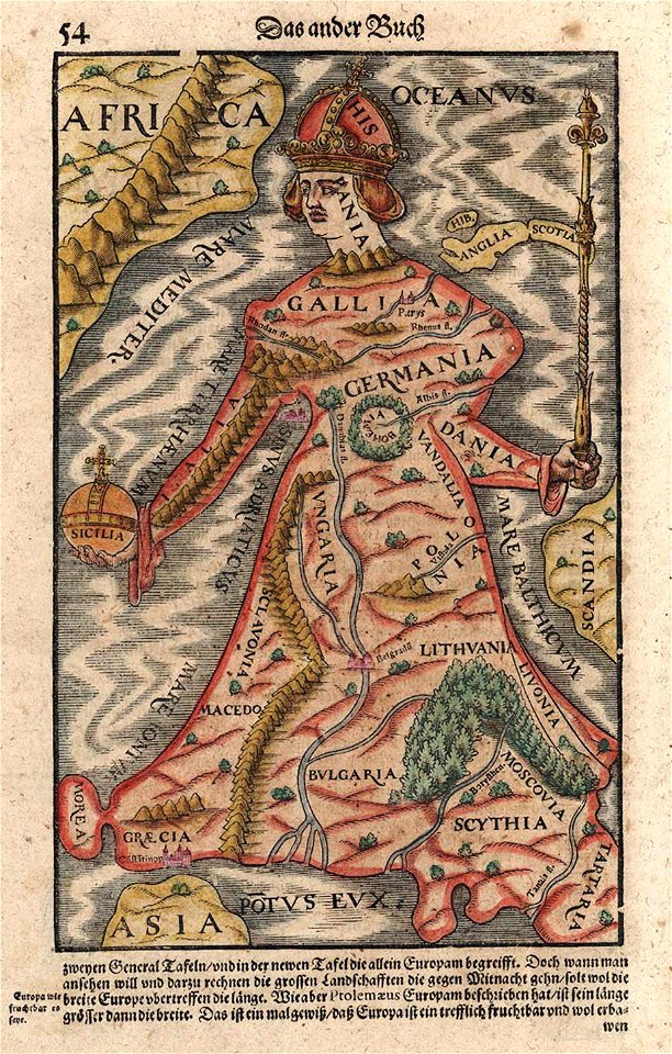
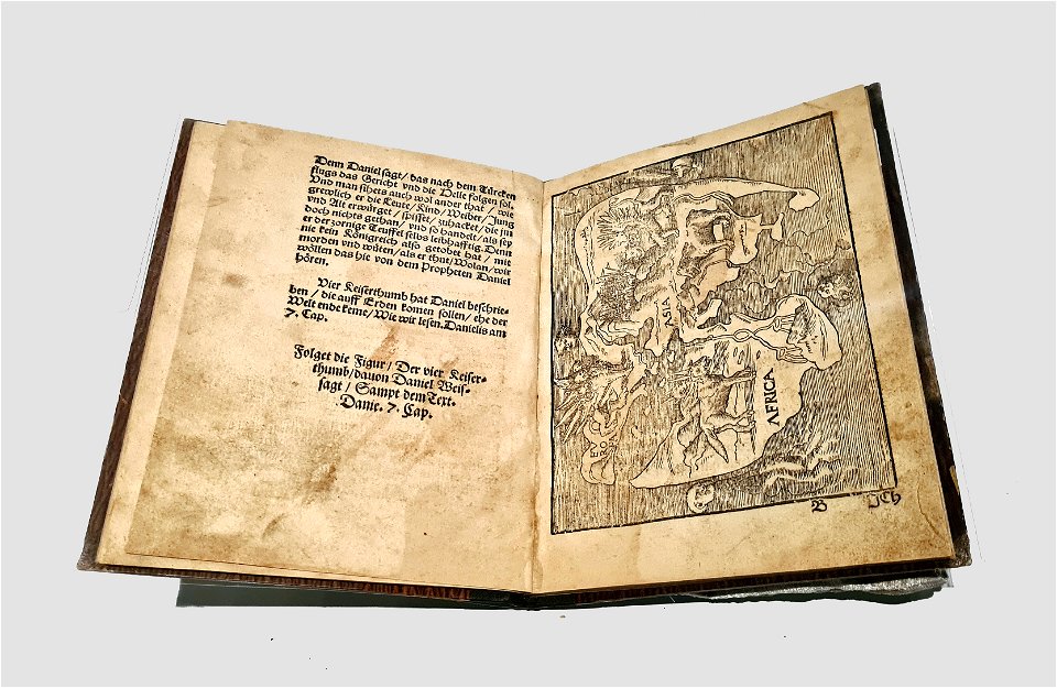
cosmographia (1600) by sebastian münster
provided by landsbókasafn íslands
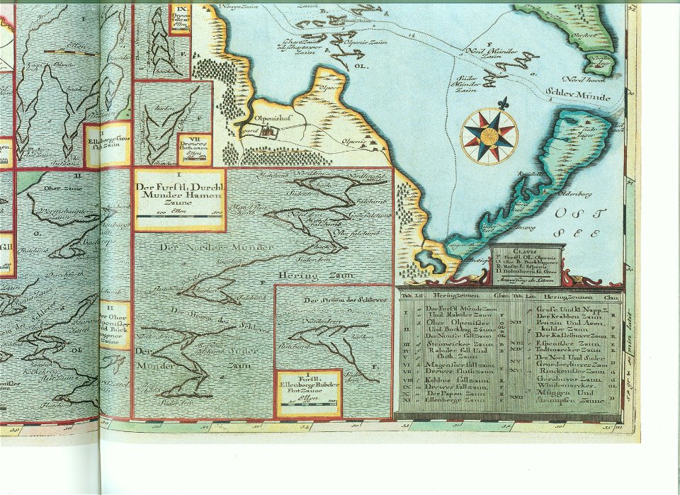
schlei
provided by landsbókasafn íslands
18th-century maps of iceland
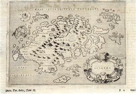
cosmographia (1600) by sebastian münster
old maps of milan
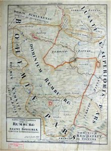
johann christoph müller
maps of rumburk
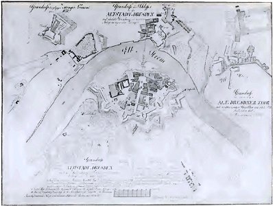
dresden (schumann)
innere neustadt
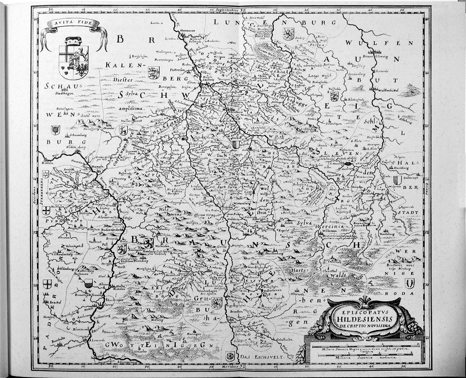
engravings of topographia saxoniae inferioris
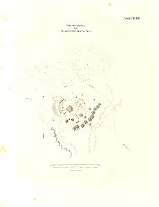
old maps of hildesheim
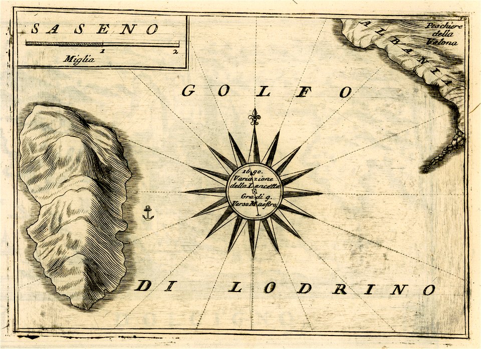
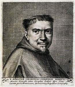
geographical illustrations by coronelli
sazan
johann christoph müller
maps of rumburk
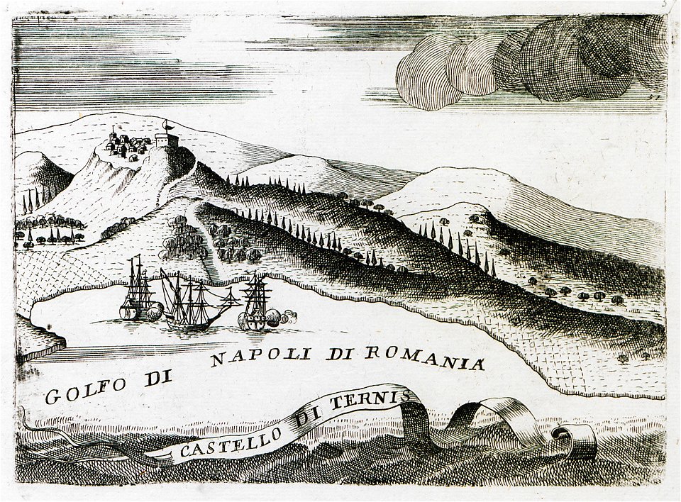
geographical illustrations by coronelli
old maps of the peloponnese
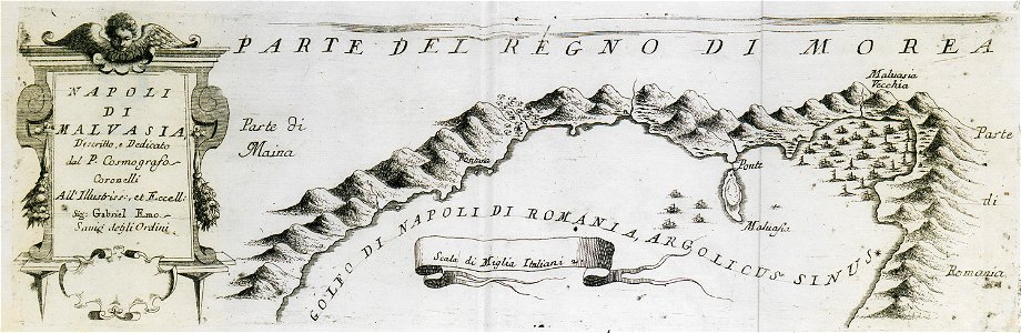
geographical illustrations by coronelli
old maps of the peloponnese
geographical illustrations by coronelli
old maps of the peloponnese
geographical illustrations by coronelli
old maps of the peloponnese
geographical illustrations by coronelli
old maps of the peloponnese
geographical illustrations by coronelli
old maps of the peloponnese
geographical illustrations by coronelli
old maps of the peloponnese
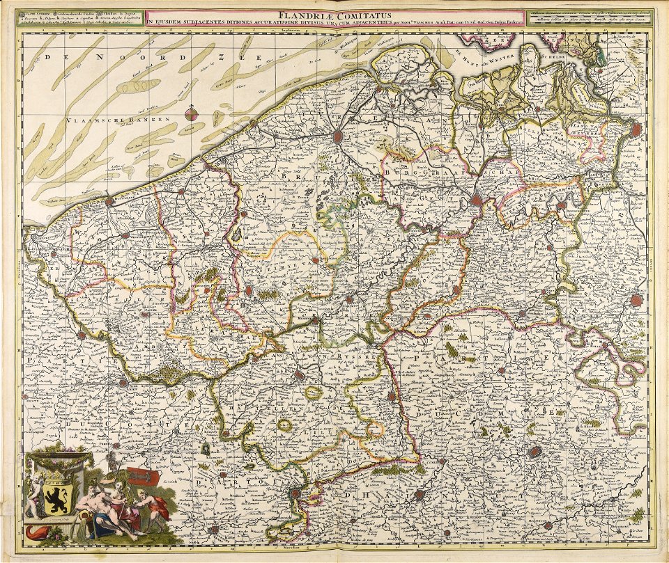
old maps of bruges
covens en mortier
cosmographia (1600) by sebastian münster
1600s maps of egypt
cosmographia (1600) by sebastian münster
1600 maps of iran
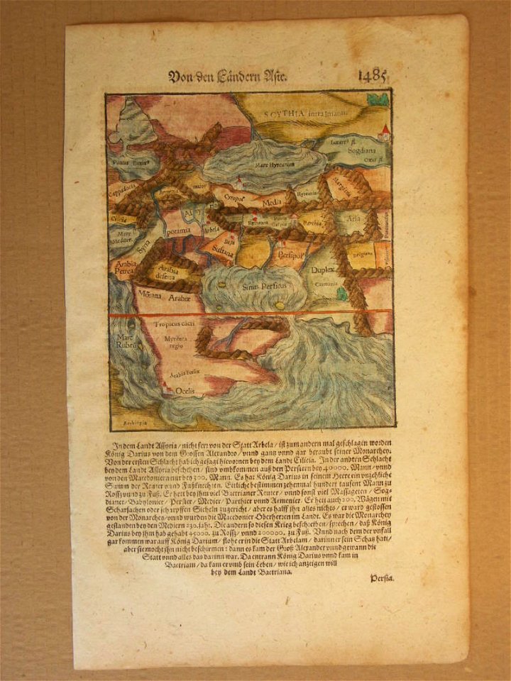
cosmographia (1588) by sebastian münster
old maps of asia
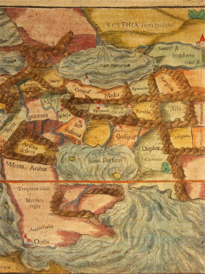
cosmographia (1600) by sebastian münster
1600 maps of iran
awa province (tokushima)
keichō kuniezu
maps of lars kietzlingh
källtorpssjön
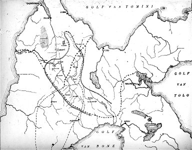
walter kaudern expedition to celebes
maps of central sulawesi
liber insularum archipelagi (royal museums greenwich)
maps of kalymnos
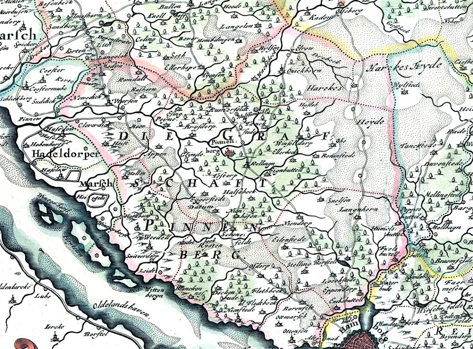
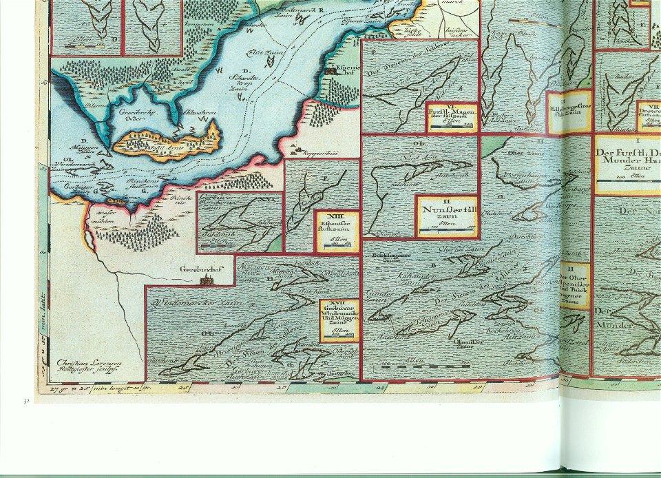
landtcarte von dem fürstenthumbe stormarn
maps of kreis pinneberg
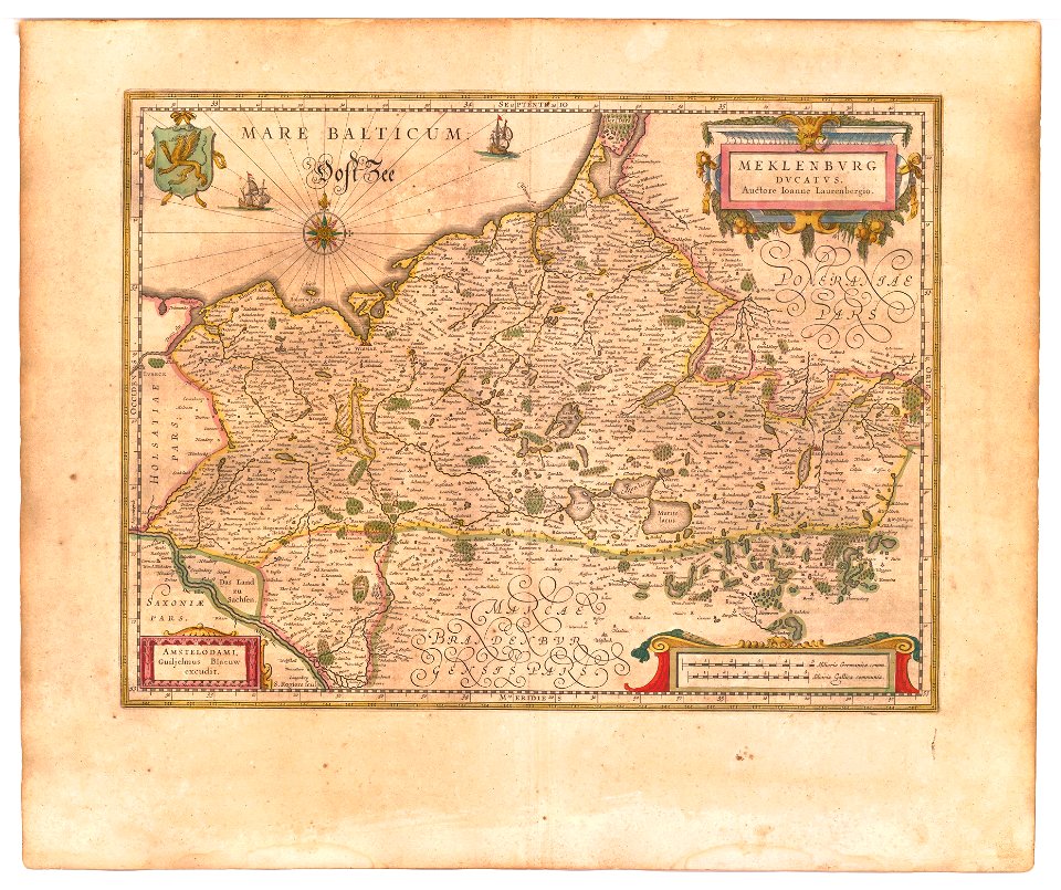
old maps of mecklenburg
atlas novus (blaeu)
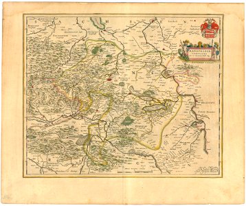
history of mansfeld land
1645 maps
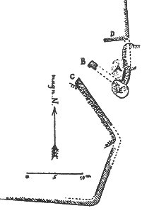
plans of castles in lower saxony
1890s maps
lepsius-projekt - pyramids
lepsius-projekt - maps
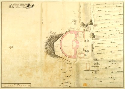
maps and plans of the device forts
cowes castle
il devotissimo viaggio di gerusalemme fatto
maps of zakynthos
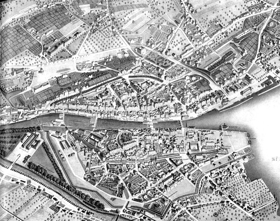
1846 in switzerland
old maps of zürich
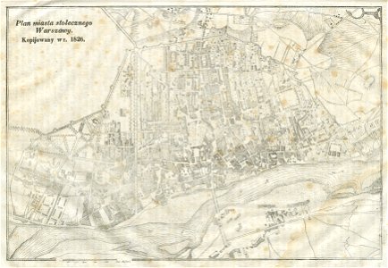
warsaw in the 19th century
historical maps of warsaw
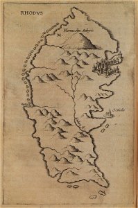
itinerarium hierosolymitanum et syriacum..., 1619
old maps of rhodes
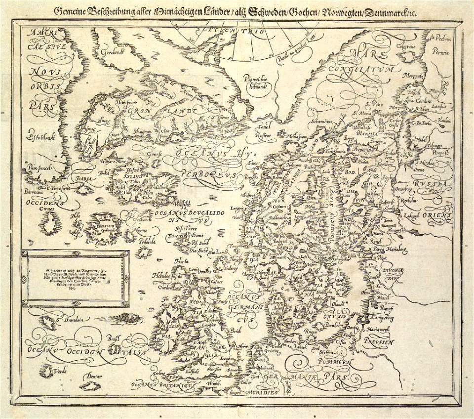
provided by landsbókasafn íslands
16th-century maps of iceland
provided by landsbókasafn íslands
maps by giovanni antonio magini
provided by landsbókasafn íslands
16th-century maps of iceland
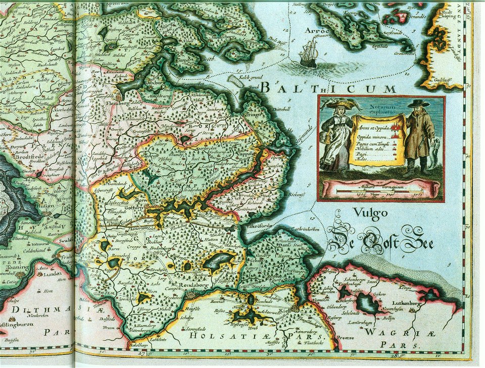
maps by johannes mejer
schlei
ducatus sleswicum sive justia australis
maps by johannes mejer
maps by johannes mejer
schlei
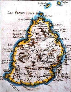
old maps of mauritius
robert surcouf
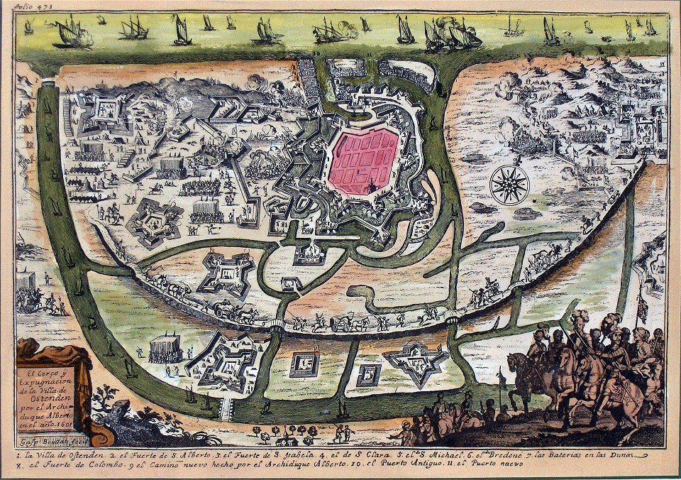
siege of ostend
low country
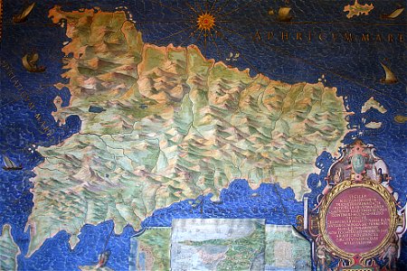
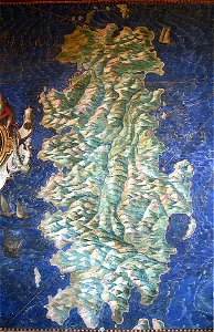
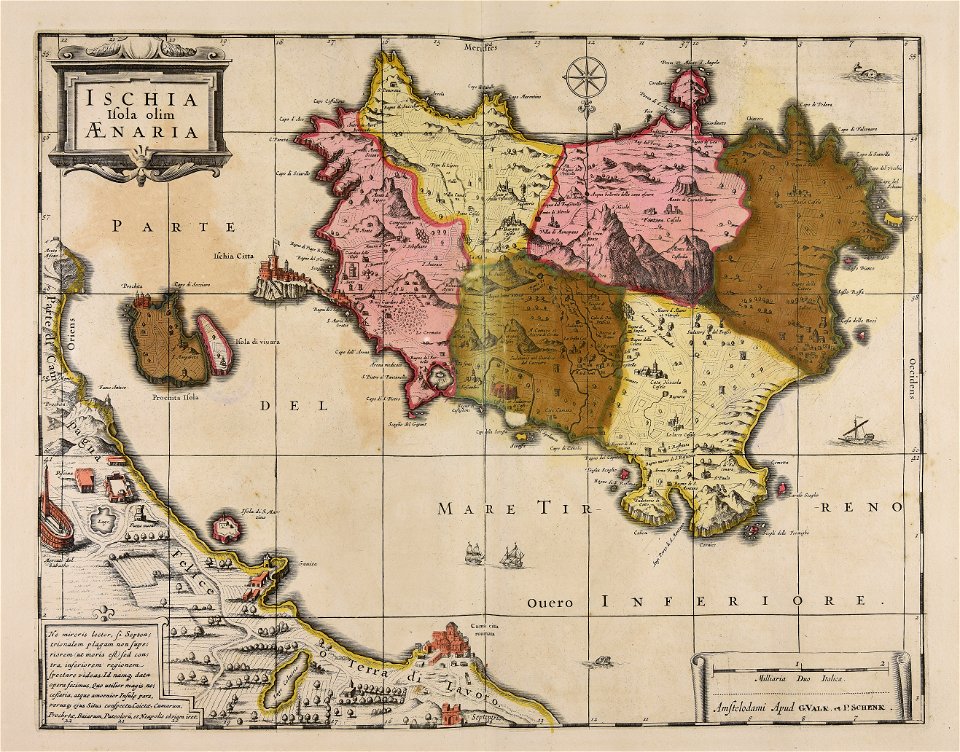
sicilia (galleria delle carte geografiche)
old maps of sicily
sardinia (galleria delle carte geografiche)
old maps of sardinia
old maps of bredevoort
pikemen
ducatus sleswicum sive justia australis
maps by johannes mejer
cosmographia (1600) by sebastian münster
1600s maps of egypt
ducatus sleswicum sive justia australis
maps by johannes mejer
maps by johannes mejer
schlei
maps by johannes mejer
schlei
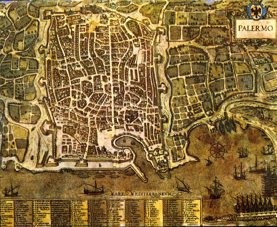
palermo
1581
maps in the library of congress
old maps of yunnan
album of forty-five figure studies (1973.9) by edgar degas
artworks without wikidata item
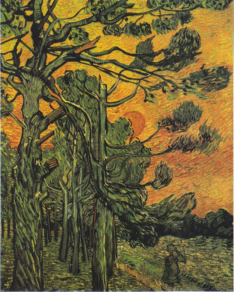
pine with female figure in the sunset
list of works by vincent van gogh
the drapery of a kneeling figure (rcin 912521)
madonna and child with saint anne
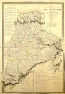
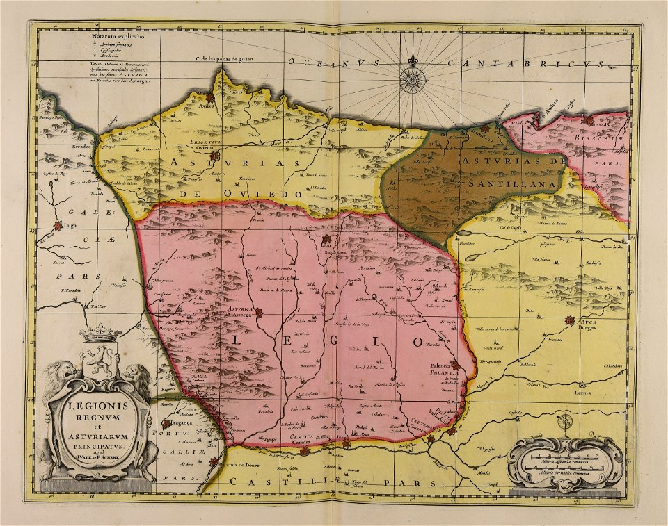
la rioja (spain) in the 19th century
cantabria in the 19th century
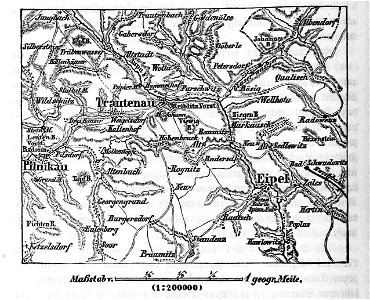
maps from the mechanical curator collection
battle of trautenau
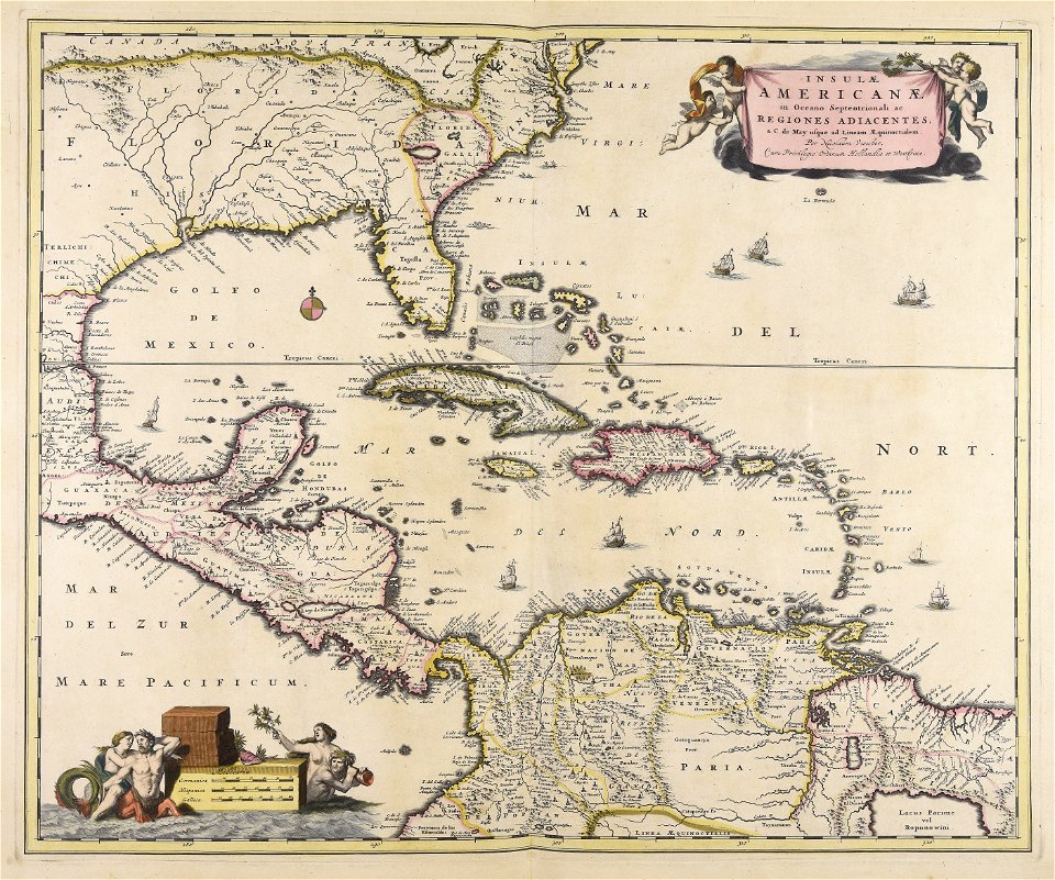
18th-century maps of hispaniola
1780 in the caribbean
maps in the library of congress
old maps of sichuan
18th-century portrait paintings in the royal collection of the united kingdom
charles boit
portrait paintings by johann zoffany
neoclassicism
portrait paintings of friedrich wilhelm i of prussia
samuel theodor gericke
cartography
bohemia
male portraits by pompeo batoni
classicism
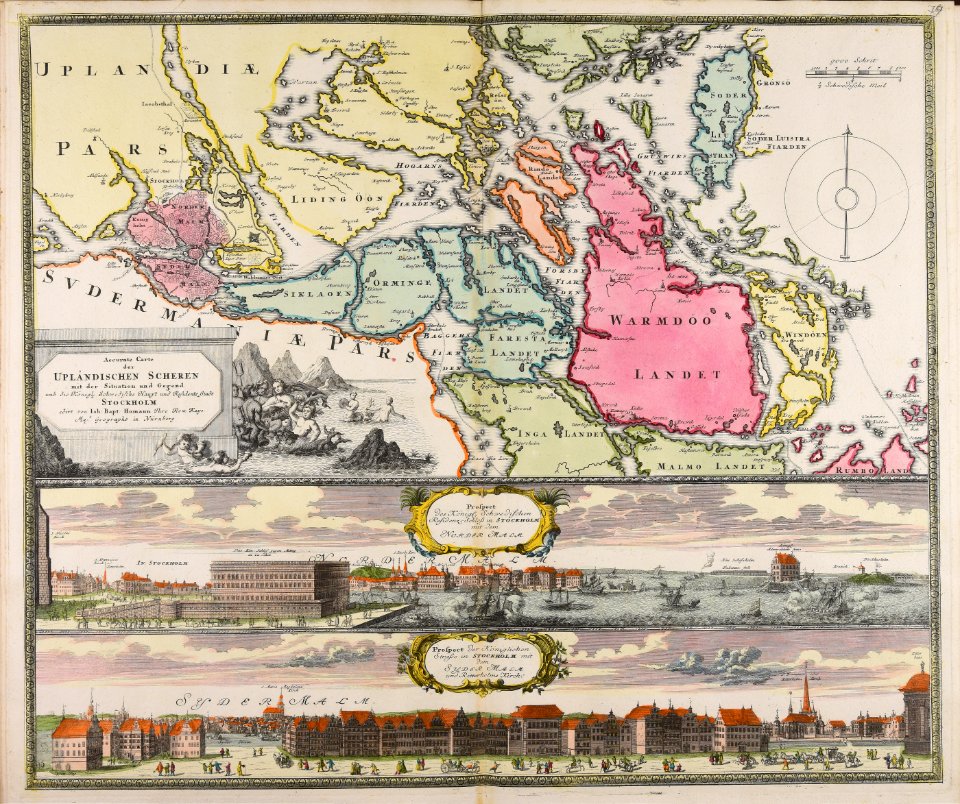
18th-century maps of stockholm
veduta
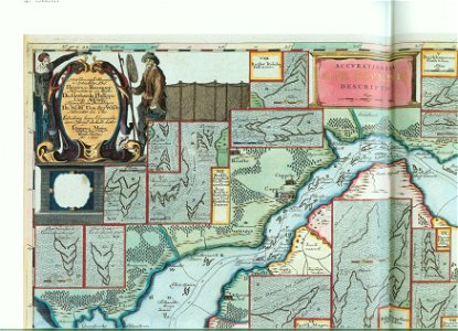
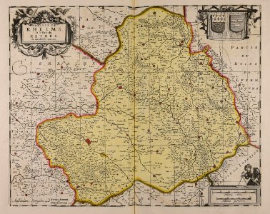
maps made in the 17th century
gerard valck
maps made in the 17th century
gerard valck
maps made in the 17th century
gerard valck
prints from the peace palace library
utrecht in the 18th century
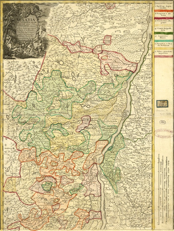
collections de la bibliothèque nationale et universitaire de strasbourg
johann baptist homann
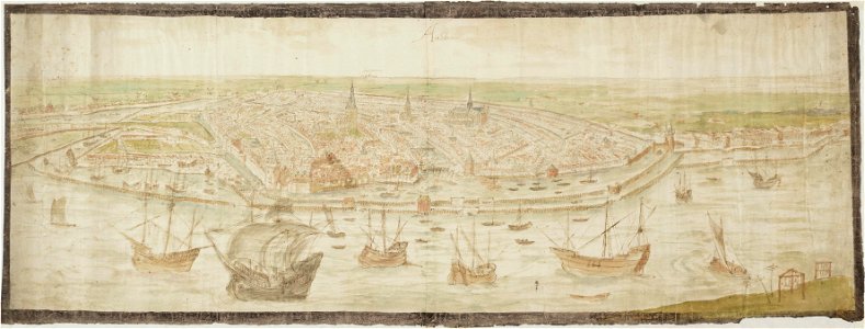
drawings in the stadsarchief amsterdam
anthonis van den wijngaerde
atlantis magni tomus tertius (biblioteca comunale di trento)
maps made in the 17th century
maps made in the 17th century
gerard valck
maps made in the 17th century
gerard valck
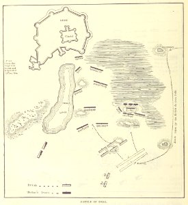
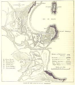
maps from the mechanical curator collection
british battles on land and sea
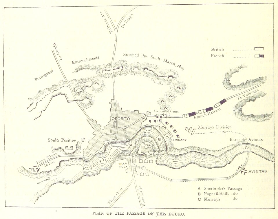
maps from the mechanical curator collection
british battles on land and sea
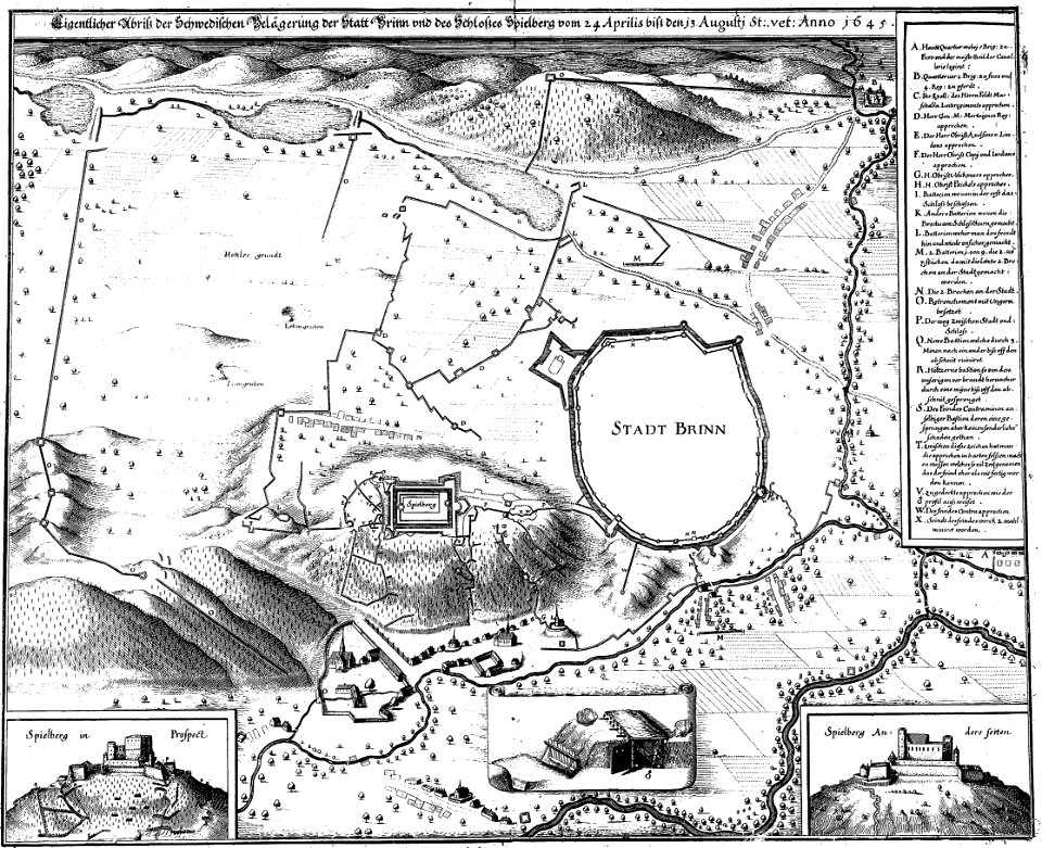
engravings of theatrum europaeum
1645 maps
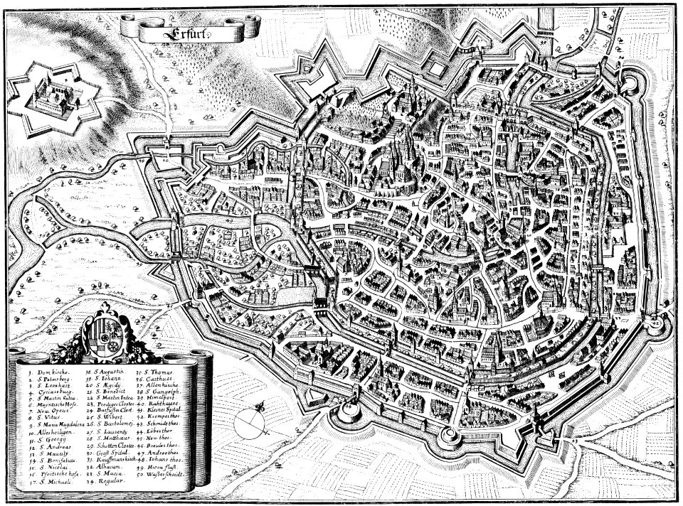
maps of erfurt
erfurt
1712 maps of puerto rico
johannes van keulen
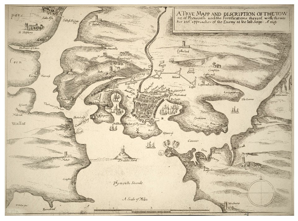
university of toronto wenceslas hollar digital collection
english civil war
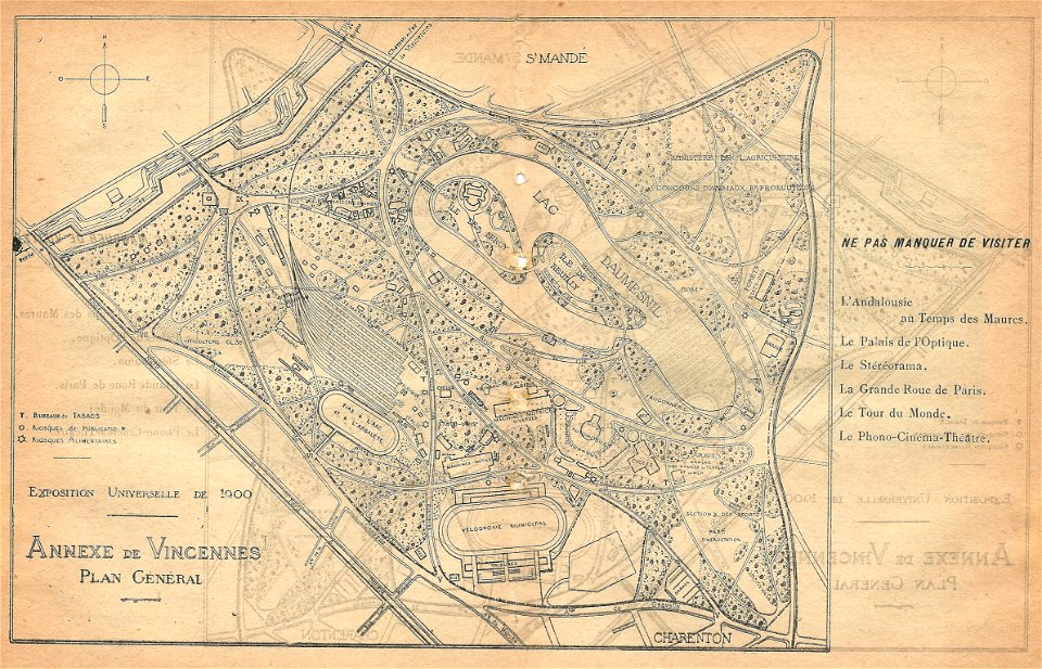
illustrations du catalogue remboursable de l'expo 1900
maps of the exposition universelle (1900)
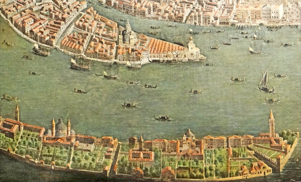
paintings of san giorgio maggiore (venice)
17th-century paintings from italy
maps made in the 17th century
nicolaes visscher ii
maps made in the 17th century
nicolaes visscher ii
maps made in the 17th century
gerard valck
maps made in the 17th century
gerard valck
collections de la bibliothèque nationale et universitaire de strasbourg
old maps of asia
mannheim in the 17th century
maps of mannheim
maps made in the 18th century
johann baptist homann
maps from the mechanical curator collection
british battles on land and sea
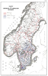
history of rail transport in norway
rail transport maps of norway
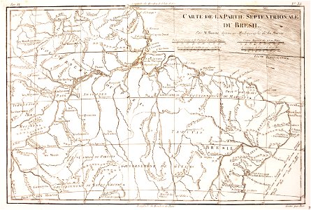
1780 in brazil
1780 maps
maps made in the 18th century
johann baptist homann
maps made in the 17th century
gerard valck
maps of waterways in the netherlands
collections of stadsarchief delft
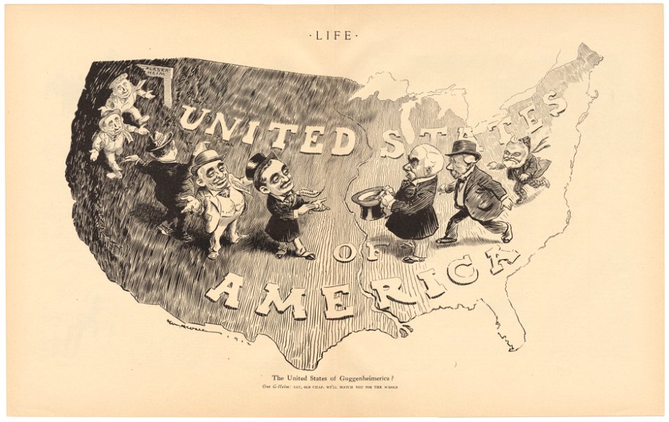
life
1912
university of toronto wenceslas hollar digital collection
old county maps of sussex
university of toronto wenceslas hollar digital collection
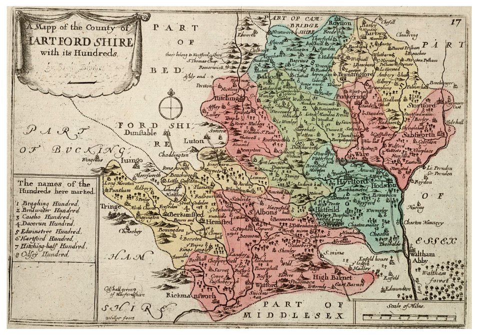
history of watford
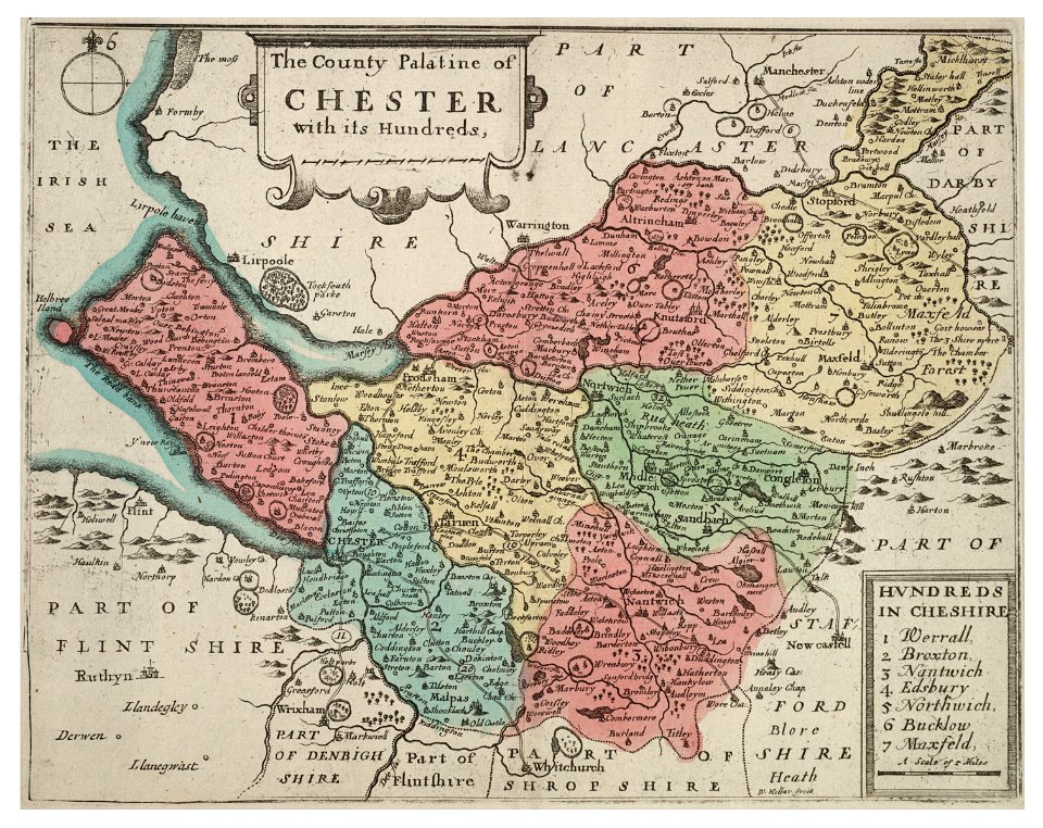
university of toronto wenceslas hollar digital collection
old county maps of cheshire
dutch paintings in the wallace collection
wallace collection - great gallery
portraits of children of india by raja ravi varma
portraits of women of kerala by raja ravi varma
7701 - 7800 of 183,459
Next page
/ 1835